
9.3· 3 reviews
Chapada Diamantina Caves Tour + Morro do Pai Inácio
On this excursion from Lençóis, we'll visit several caves in the Chapada Diamantina and the surroundings of the famous Morro do Pai Inácio.
10 h 30 min
from US$ 118
Chapada Diamantina calls for 4 to 5 days: distances are deceptive and each excursion takes the whole day, among caves, viewpoints and at least one long hike. The window with the best weather runs from June to September; September is the driest month (26 mm of rain over 6 days), with highs of 27 to 30 °C. Summer is hotter (a high of 32 °C in January) and rainy (164 mm in March, spread over 13 days).
Chapada Diamantina is a region of mountains in central Bahia, about 400 km from Salvador. The name comes from mining: in the 19th century, the diamond rush gave rise to towns like Lençóis, Mucugê and Igatu, and the village architecture of that era still stands, with its colorful doors and windows. When the stones ran out, the towns shrank. In 1985 the Chapada Diamantina National Park was created, with 152,000 hectares spread across five municipalities, and hiking tourism took the place of mining.
Almost everyone stays in Lençóis, which has the pousadas (small inns), restaurants and tour agencies, and from there the day excursions depart: the Morro do Pai Inácio, about 30 km away, the Gruta da Lapa Doce, the Poço Azul (Blue Well) and the Poço Encantado (Enchanted Well), where the midyear sun comes in through a crack in the rock and turns the water blue. The other base is the Vale do Capão, more rustic. From there the trail leaves for the top of the Cachoeira da Fumaça, with a drop of about 340 meters, and for the Vale do Pati trek, which is done with a guide.
Distances are deceptive. The Poço Azul is 86 km from Lençóis and the Poço Encantado is 140 km, so each excursion takes the whole day. That is why four to five days is the right amount of time, and more if you want to do the Pati. The highest point in the Northeast, the Pico do Barbado, at 2,033 meters, is also in the Chapada, but far from the circuit of those who stay in Lençóis.
Updated on October 19, 2026
A flooded cave where, with sun between April and September, light comes in and tints the water a vivid blue. You can float in a life vest over the crystal-clear bottom.
An underground lake of transparent water with a bottom visible dozens of meters down. Between April and September the sun comes in through the opening and creates an intense blue. It is for looking only, with no swimming.
With a drop of about 340 meters, it is one of the tallest in Brazil. The wind breaks the water into mist before it reaches the ground. It is reached from above, from the Vale do Capão, by a trail of about 5 km.
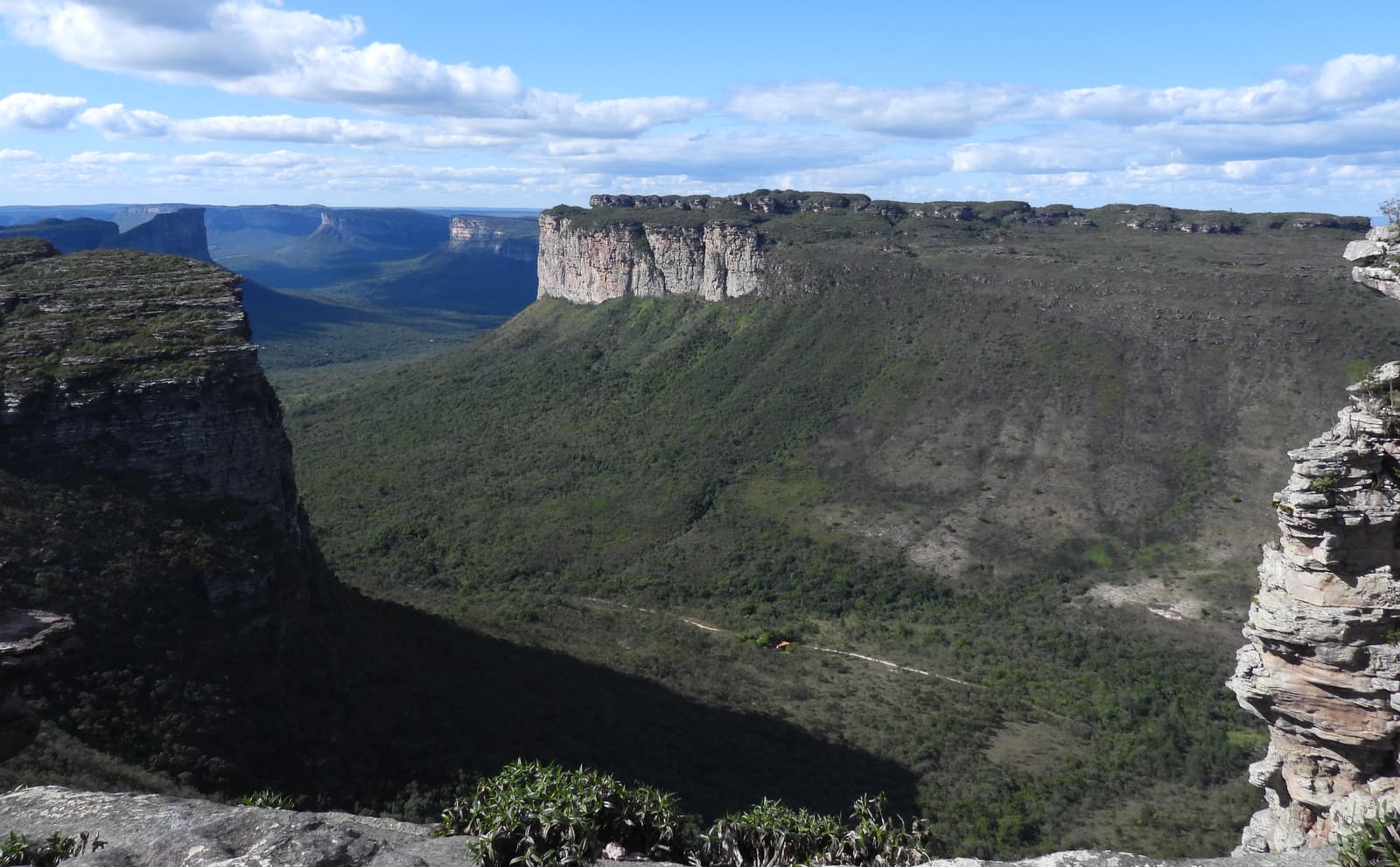
The most famous viewpoint in the Chapada, about 30 km from Lençóis along the BR-242. Panoramic views of the valleys and the flat-topped hills, a classic for sunset.
A large dry cave with stalactites, stalagmites and chambers explored on foot with a guide and a flashlight. One of the most impressive in the region.
An alternative village surrounded by mountains, a base for trails such as the Vale do Pati and for access to the top of the Cachoeira da Fumaça. A quiet, community-oriented atmosphere.
A series of small drops and natural water slides a few minutes' walk from the center of Lençóis. Ideal for a quick swim without needing a car.
Brazil is in the Southern Hemisphere, so the seasons are the reverse of those in Europe and North America: summer in the Chapada falls between December and March and winter between June and September. The reference climate data comes from the INMET station in Lençóis, at 394 m above sea level; the higher villages, such as the Vale do Capão and Mucugê, tend to have colder nights. Summer is hot, with highs of 32 °C in January and February. In July and August, the coolest months, the average high is 27 °C and the low is 17 °C.
September is the driest month, with 26 mm of rain over 6 days; it is followed by August (40 mm over 7 days) and July (42 mm over 9 days). The wettest are March (164 mm over 13 days), November (135 mm over 13 days) and January (133 mm over 13 days). The rain fills the waterfalls, but it can close trails.
With those numbers, the best window to visit runs from June to September, with August as the best month. From April to September, in the dry season, the trails are firmer and the sun lights up the blue of the caves: the Poço Azul and the Poço Encantado need the sun directly overhead. From November to March it rains more. These are multi-year averages, not a guarantee for your dates.
| Month | High | Low | Rain | Rainy days | Rating |
|---|---|---|---|---|---|
| January | 32 °C | 20 °C | 133 mm | 13 | Fair |
| February | 32 °C | 21 °C | 94 mm | 10 | Fair |
| March | 31 °C | 21 °C | 164 mm | 13 | Fair |
| April | 30 °C | 20 °C | 114 mm | 12 | Fair |
| May | 28 °C | 19 °C | 63 mm | 10 | Good |
| June | 27 °C | 18 °C | 56 mm | 9 | Good |
| July | 27 °C | 17 °C | 42 mm | 9 | Good |
| August | 27 °C | 17 °C | 40 mm | 7 | Good |
| September | 30 °C | 18 °C | 26 mm | 6 | Good |
| October | 32 °C | 19 °C | 76 mm | 9 | Good |
| November | 31 °C | 20 °C | 135 mm | 13 | Fair |
| December | 31 °C | 20 °C | 116 mm | 13 | Fair |
Monthly averages for 1991-2020 from INMET (Brazil's National Institute of Meteorology). The rating combines rainfall, temperature and humidity.
In summer (December to February), Chapada Diamantina has highs of around 32 °C (90 °F) and lows of 20 °C (68 °F), and it is the wetter season, with about 114 mm of rain spread over about 12 days a month. The days are hot and call for beach time and shade.
In fall (March to May), Chapada Diamantina has highs of around 30 °C (86 °F) and lows of 20 °C (68 °F), and it is the wetter season, with about 114 mm of rain spread over about 12 days a month. The days are hot and call for beach time and shade.
In winter (June to August), Chapada Diamantina has highs of around 27 °C (81 °F) and lows of 17 °C (63 °F), and it is the driest time of year, with about 46 mm of rain a month. Temperatures are pleasant for sightseeing all day.
In spring (September to November), Chapada Diamantina has highs of around 31 °C (88 °F) and lows of 19 °C (66 °F), and it is the wetter season, with about 79 mm of rain spread over about 9 days a month. The days are hot and call for beach time and shade.
Weather, crowds, prices and what is happening at the destination in each period. Tap a month to open its full page; the colored dot shows how good the time is for a visit.
A religious festival held from January 23 to February 2 since 1852, recognized in 2026 as Brazilian Cultural Heritage by Iphan.
A June festival with forró (northeastern dance music) and traditional foods in the town's central square.
A free music festival held since 1999, with concerts at Praça Horácio de Mattos.
Recurring annual events: exact dates change every year, so confirm them before you plan your trip.
The main air access is Salvador International Airport (SSA), about 410 km from Lençóis. Lençóis also has its own airport, with seasonal and limited flights.
From Salvador, the overland route to Lençóis is 410 km along the BR-242, about 6 h by car. There are also bus lines from the state capital.
Routes and airlines change often; the safest approach is to check them when planning your trip.
Lençóis is the most practical base: it has the pousadas, restaurants and tour agencies, and from there the day excursions leave for the Morro do Pai Inácio, the caves and the wells. The Cachoeira do Serrano is a few minutes' walk from the center. The Vale do Capão is smaller and more rustic, and makes sense for anyone planning to climb to the Cachoeira da Fumaça or do the Vale do Pati trek, which start from there.
Rates change with the dates: confirm the price on Booking.com.
From April to September, the driest season, the trails are firm and the sun enters the caves and lights up the blue of the Poço Azul and the Poço Encantado. The window with the best weather runs from June to September, with September as the driest month (26 mm). From November to March it rains more, which fills the waterfalls but can close trails.
Four to five days let you combine the excursions to caves and viewpoints, such as the Poço Azul, the Pai Inácio and the Lapa Doce, with at least one longer trail, such as the Cachoeira da Fumaça or the Vale do Pati.
Lençóis is the most practical base: it has more pousadas, restaurants and tour agencies, and from there the day excursions leave for the Morro do Pai Inácio, the caves and the wells. The Vale do Capão is smaller and more rustic, and makes sense for anyone planning to climb to the Cachoeira da Fumaça or do the Vale do Pati trek, which start from there.
It is about 410 km to Lençóis along the BR-242, about 6 h by car. There are also seasonal flights to the Lençóis airport and bus lines from the state capital.
No. Lençóis is a town in the interior of Bahia, the main base for Chapada Diamantina. The Lençóis Maranhenses are a park of dunes and lagoons on the coast of Maranhão, more than a thousand kilometers away. The confusion is common because, in everyday speech, "Lençóis" almost always refers to the park in Maranhão.
For the long trails, such as the Cachoeira da Fumaça via the Vale do Capão and the Vale do Pati, yes: an accredited local guide is required and advisable for safety. The waterfalls near the center can be done on your own.
The weather and population data in this guide come from official agencies and open databases. Entry requirements and health recommendations change: always check the official source linked.


