10· 2 reviews
Ziplining in Chapada dos Veadeiros
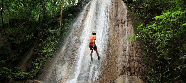
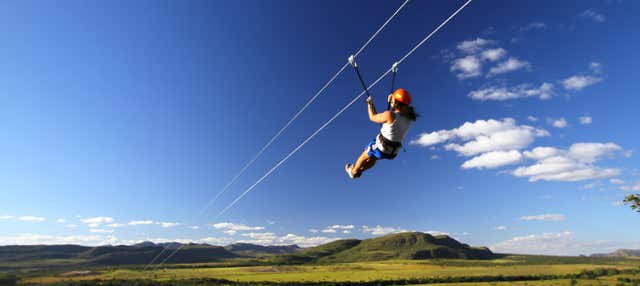
On this ziplining activity in Chapada dos Veadeiros, you'll feel the rush while enjoying the most beautiful landscapes of Goiás.
2 h
from US$ 49
Chapada dos Veadeiros calls for 4 to 6 days, because the waterfalls are spread out and some trails take the whole day. The window with the best weather runs from May to August: June, the best month, has almost no rain (2 mm, no rainy days), with highs of 29 to 31 °C and lows of 18 to 20 °C. From November to March the waterfalls fill up, but the rain is heavy (up to 237 mm in December, spread over 16 days).
Chapada dos Veadeiros is one of the oldest places on Earth you can walk on: the plateau is made of rocks more than 1.8 billion years old, rich in quartz crystals that give the ground a glow of its own. Everything revolves around two bases: Alto Paraíso de Goiás, the highest town in the Center-West, at 1,232 meters, and the small Vila de São Jorge, at the gate of the National Park. The park, a UNESCO Natural World Heritage Site, protects one of the last large blocks of high-altitude Cerrado (Brazil's tropical savanna), with fauna and flora found nowhere else.
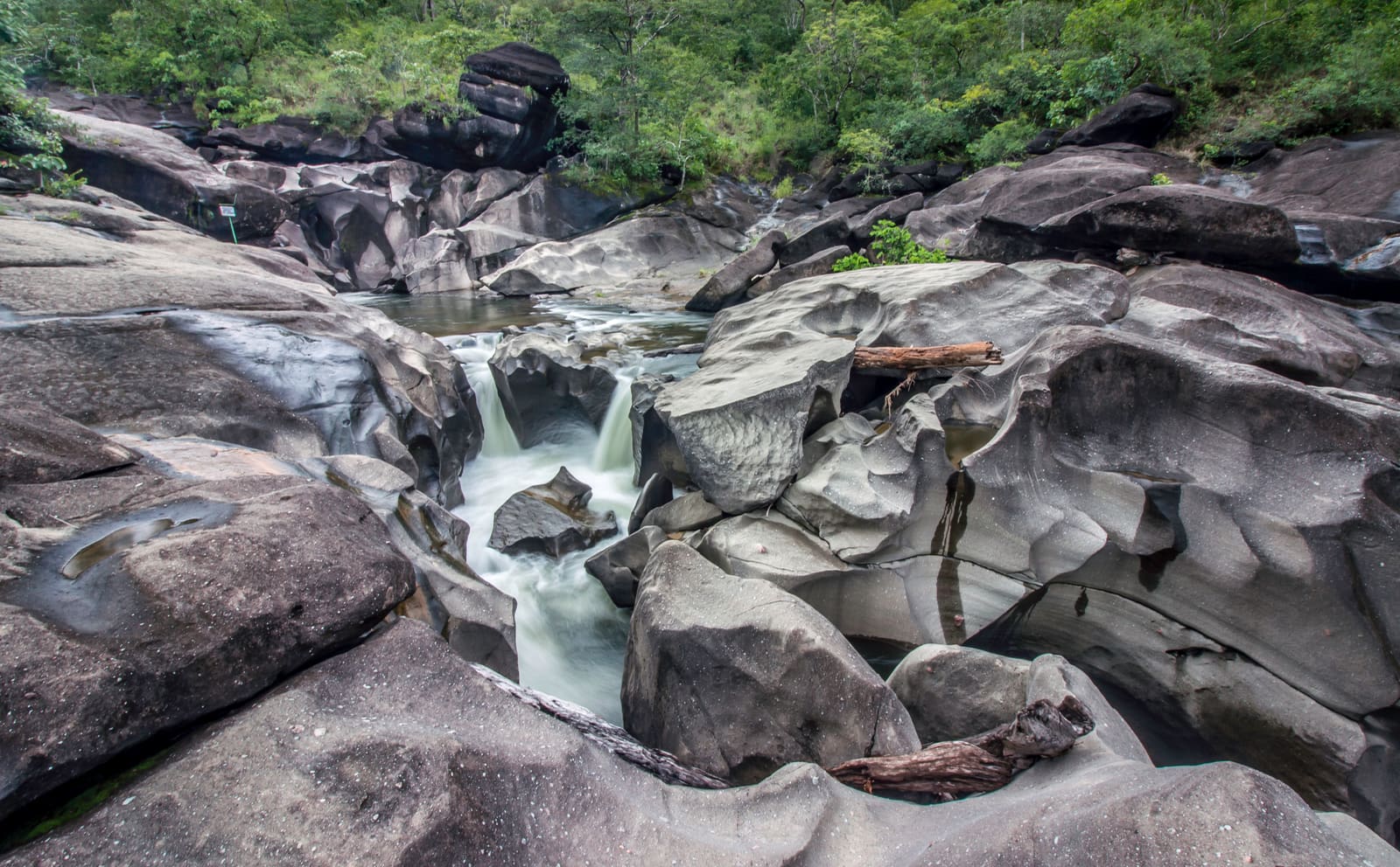
What you do here is hike and get wet. The Vale da Lua (Moon Valley), sculpted by the São Miguel River, looks like a lunar landscape of gray rock polished by water over millennia. Inside the park, the Saltos do Rio Preto trail leads to two drops of 80 and 120 meters, and the Cânions and Cariocas trail mixes rock walls with shallow pools perfect for children. Outside the park, the Cataratas dos Couros add a sequence of waterfalls on private land, and Loquinhas has natural pools on gentle slopes.
But the Chapada is not just for the daytime. Because it is far from big cities, at altitude and with dry air in winter, the night sky is among the clearest in Brazil: Alto Paraíso is a stargazing spot, and for decades the region has nurtured an alternative culture of communities, therapies and crystals. The climate helps: the Cerrado has two well-defined seasons, a rainy summer from November to March, when the waterfalls fill up, and a dry winter with warm days and nights that can turn surprisingly cold on the plateau.
Updated on October 19, 2026
Gray rock formations polished over millennia by the São Miguel River, creating a moon-like landscape, with pools for swimming among the stones.
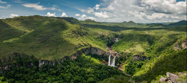
Inside the National Park, two drops of 80 and 120 meters (the tallest in the Chapada) reached by a trail of about 12 km round trip.
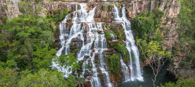
A sequence of waterfalls on private land outside the park, with wide drops and natural pools of crystal-clear water between quartz walls.
A trail inside the park that combines the rock walls of Cânion 2 with shallow pools and the Cachoeira das Cariocas, ideal for a relaxing swim.
A Cerrado plain dotted with buriti palms and termite mounds, with the Serra da Baleia in the background. One of the best places in the region to watch the sunset.
A set of natural pools on gentle slopes, with calm water that is warm by Chapada standards; a good choice for families.
Brazil is in the Southern Hemisphere, so the seasons are the reverse of those in Europe and North America: summer in the Chapada falls between December and March and winter between June and September. The Cerrado has two well-defined seasons: the rainy one, from November to March, and the dry one, from May to September. Highs range from 29 to 31 °C in the dry months and reach 33 °C in September, the hottest month. In June and July, the coolest, the average high is 29 °C and the low is 18 °C. The reference climate data comes from the Posse station, the nearest; on the plateau, at 1,232 meters, winter nights can be colder, sometimes close to 10 °C.
July is the driest month, with no rain (0 mm and 0 days), followed by June (2 mm and 0 days) and August (5 mm and 0 days). The wettest are December (237 mm over 16 days), March (227 mm over 15 days) and November (221 mm over 15 days), with a risk of heavy rain and sudden river floods.
With those numbers, the best window to visit runs from May to August, with June as the best month: firm trails and starry skies. From November to March the waterfalls are fuller, in exchange for a higher risk of rain. These are multi-year averages, not a guarantee for your dates.
| Month | High | Low | Rain | Rainy days | Rating |
|---|---|---|---|---|---|
| January | 30 °C | 20 °C | 200 mm | 15 | Fair |
| February | 30 °C | 20 °C | 192 mm | 14 | Fair |
| March | 30 °C | 21 °C | 227 mm | 15 | Fair |
| April | 30 °C | 21 °C | 121 mm | 9 | Good |
| May | 30 °C | 20 °C | 28 mm | 3 | Very good |
| June | 29 °C | 18 °C | 2 mm | 0 | Very good |
| July | 29 °C | 18 °C | 0 mm | 0 | Very good |
| August | 31 °C | 19 °C | 5 mm | 0 | Very good |
| September | 33 °C | 21 °C | 13 mm | 2 | Very good |
| October | 32 °C | 22 °C | 100 mm | 8 | Good |
| November | 30 °C | 21 °C | 221 mm | 15 | Fair |
| December | 30 °C | 21 °C | 237 mm | 16 | Fair |
Monthly averages for 1991-2020 from INMET (Brazil's National Institute of Meteorology). The rating combines rainfall, temperature and humidity.
In summer (December to February), Chapada dos Veadeiros has highs of around 30 °C (86 °F) and lows of 20 °C (68 °F), and it is the wetter season, with about 210 mm of rain spread over about 15 days a month. The days are hot and call for beach time and shade.
In fall (March to May), Chapada dos Veadeiros has highs of around 30 °C (86 °F) and lows of 21 °C (70 °F), and it is the wetter season, with about 125 mm of rain spread over about 9 days a month. The days are hot and call for beach time and shade.
In winter (June to August), Chapada dos Veadeiros has highs of around 30 °C (86 °F) and lows of 18 °C (64 °F), and it is the driest time of year, with about 2 mm of rain a month. The days are hot and call for beach time and shade.
In spring (September to November), Chapada dos Veadeiros has highs of around 32 °C (90 °F) and lows of 21 °C (70 °F), and it is the wetter season, with about 111 mm of rain spread over about 8 days a month. The days are hot and call for beach time and shade.
Weather, crowds, prices and what is happening at the destination in each period. Tap a month to open its full page; the colored dot shows how good the time is for a visit.
A popular religious celebration with prayers, songs, catira (a folk dance) and folia camps in the villages of Alto Paraíso, between late June and early July.
A gathering of music, dance and faith held since 2001 in Vila de São Jorge, bringing together artists, traditional communities, quilombolas (descendants of escaped enslaved people) and Indigenous peoples.
A cultural immersion in Alto Paraíso de Goiás that brings together different Indigenous peoples to share traditions and knowledge, held in July.
Recurring annual events: exact dates change every year, so confirm them before you plan your trip.
The gateway is Juscelino Kubitschek International Airport (BSB), in Brasília, about 230 km from Alto Paraíso de Goiás. The Vila de São Jorge, the gateway to the park, is another 36 km farther on.
From Brasília, the overland route to Alto Paraíso is 230 km along the BR-010 and the GO-118, about 3 h 30 min by car.
Routes and airlines change often; the safest approach is to check them when planning your trip.
Alto Paraíso has more infrastructure, restaurants and hospitals; São Jorge is a smaller, more rustic village, closer to the entrance of the National Park. Many travelers split their nights between the two. Internet and cell service are unreliable in São Jorge and on the trails, so it pays to arrange in advance anything that depends on a connection.
Rates change with the dates: confirm the price on Booking.com.
Alto Paraíso has more infrastructure, restaurants and hospitals; São Jorge is a smaller, more rustic village, closer to the entrance of the National Park. Many travelers split their nights between the two.
For several trails in the National Park and on private properties, an accredited guide is required. For some of the simpler attractions, it is not.
May to August is the window with the best weather, with June as the best month. The dry season (May to September) gives you firm trails and starry skies; the rainy season (November to March) leaves the waterfalls full, but with a risk of heavy rain and sudden floods.
On the plateau, at 1,232 meters, winter nights can be cold, sometimes close to 10 °C, while the days stay warm and dry. Bring a coat.
Four to six days are enough for the main attractions without rushing, since the waterfalls are spread out and some trails take the whole day.
Mostly yes: it comes from high-altitude springs. Loquinhas and some shallow pools in the Cânion tend to be warmer.
The weather and population data in this guide come from official agencies and open databases. Entry requirements and health recommendations change: always check the official source linked.