8.4· 5 reviews
Transport Between Campo Grande Airport & Bonito
If you're unsure how to travel between Campo Grande airport and Bonito, worry no more! This shuttle service provides a hassle-free transfer.
10 h
from US$ 45
Bonito is worth 3 to 4 days to combine a cave, one or two river floats, a river swimming spot and, if you want adventure, the rappel into the Abismo Anhumas. The best window runs from May to August, with 36 to 88 mm of rain a month and highs of 27 to 30 °C; July is the driest month and also the busiest. Summer is hotter (31 °C) and rainier, with up to 225 mm in January, and the rivers can turn cloudy after storms.
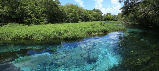
Bonito is in the south of Mato Grosso do Sul, on the edge of the Serra da Bodoquena, and became famous for an unusual geological detail: the limestone soil filters rainwater and deposits calcium carbonate, which traps suspended particles and leaves the rivers with an almost unreal transparency. That is why here you "float" instead of diving: you drift down the river carried by the current, with mask and snorkel, watching dourado, piraputanga and curimbatá fish pass a few inches from your face. Besides floating, Bonito has caves with blue lakes, sinkholes for rappelling and diving, river swimming spots for a family day out and waterfalls in the forest.
The town is small, with just over 23,000 residents, but it organized tourism in a way that became a benchmark in Brazil: almost all the attractions are on private property and operate by advance reservation, with a limited number of visitors per day and a mandatory voucher bought through an agency. That control of visitor flow is what keeps the water clean and the experience uncrowded, and it is also why it pays to plan the trip well ahead, because the most sought-after tours sell out. Most of the budget goes to the tours, not to lodging: each attraction is charged per person, with an accredited guide and equipment included, and a float with a trail or a cave takes half a day. In three or four days it is normal to choose four to six activities and alternate a pricey tour day with a cheaper day at a river swimming spot.
The climate is tropical and warm much of the year, with rainy summers and drier, milder winters. It is a destination that combines light adventure, direct contact with nature and the pace of an inland pousada (small inn), and you do not need to be an athlete to enjoy it. Part of the lodging is in rural pousadas and farm hotels spread across the Serra da Bodoquena, with trails and river swimming from the property itself. As for the best time to go, the practical rule is short: transparent water goes with the dry season. From May to September it rains little in southern Mato Grosso do Sul, the rivers have their peak visibility and the temperature stays in a comfortable range.
Updated on October 19, 2026
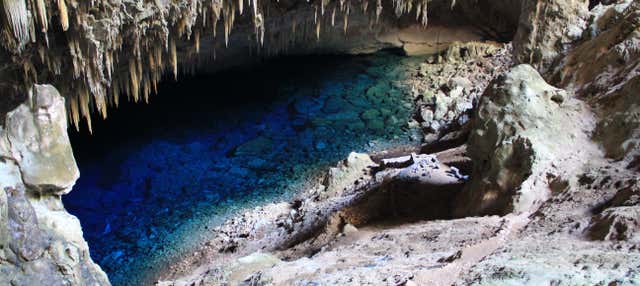
A cave where a staircase leads down to an intensely blue lake, lit by the light that enters through the mouth of the cave. A protected natural monument, with controlled hours and visitor numbers.
A trail through the forest followed by a float down a spring-fed river with exceptional visibility, surrounded by schools of fish. It is one of the classic tours in Bonito.
A gentle float through calm, transparent water, ideal if you want a more relaxing, contemplative tour among aquatic plants and fish.
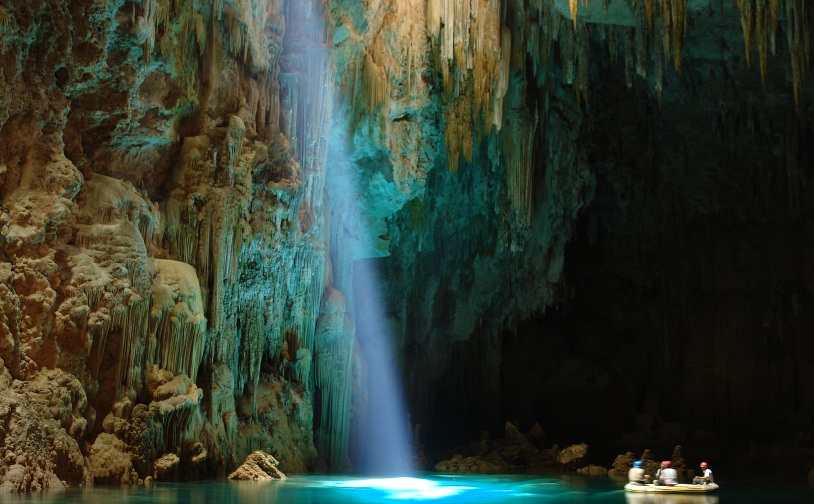
A 72-meter rappel down a fissure to an underground lake where you can dive or float among limestone cones. It is a tour for anyone up for an adrenaline rush.
A huge sinkhole with reddish walls where dozens of red macaws nest. A short trail with lookouts over the abyss.
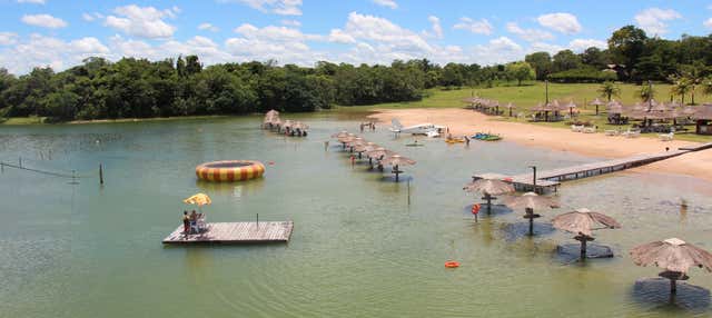
A swimming area on the banks of the Formoso River, with clear water, fish, kiosks and forest all around. An affordable option for a family day out.
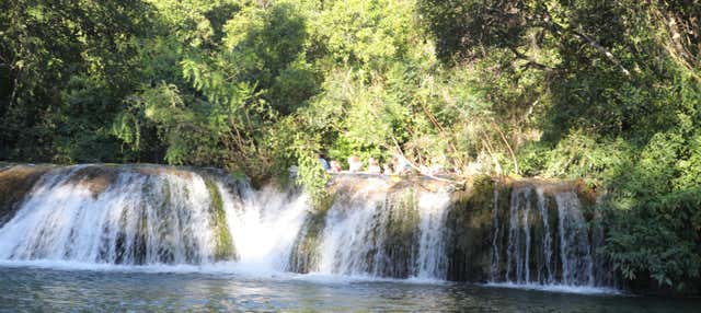
A trail among waterfalls in the Serra da Bodoquena, including the biggest waterfall drop in the state, with options for swimming and rappelling. A full day of nature.
Brazil is in the Southern Hemisphere, so the seasons run opposite to those in Europe and North America: summer in Bonito falls between December and March and winter between June and August. Summer is hot, with highs of 31 °C between December and March, and winter is mild: in July, the coolest month, the average high is 28 °C and the low is 15 °C.
The dry season runs from May to September. The months with the least rain are July (36 mm over 3 days), August (46 mm over 3 days) and June (47 mm over 4 days). The wettest are January (225 mm over 15 days), December (206 mm over 13 days) and February (176 mm over 13 days). After heavy summer storms, the rivers can stay cloudy for a few days.
In terms of weather, the best window runs from May to August, with July the best month. July is the driest month of the year and also the most crowded, because of school vacations; if you can choose your dates, you usually find the best balance in May, June or September. These are historical averages and do not guarantee the weather on any given day. The reference climate data is from the Campo Grande station.
| Month | High | Low | Rain | Rainy days | Rating |
|---|---|---|---|---|---|
| January | 31 °C | 21 °C | 225 mm | 15 | Fair |
| February | 31 °C | 21 °C | 176 mm | 13 | Not recommended |
| March | 31 °C | 21 °C | 150 mm | 11 | Fair |
| April | 30 °C | 19 °C | 89 mm | 7 | Good |
| May | 27 °C | 17 °C | 88 mm | 5 | Very good |
| June | 27 °C | 16 °C | 47 mm | 4 | Very good |
| July | 28 °C | 15 °C | 36 mm | 3 | Very good |
| August | 30 °C | 17 °C | 46 mm | 3 | Very good |
| September | 31 °C | 18 °C | 78 mm | 6 | Good |
| October | 31 °C | 20 °C | 151 mm | 9 | Fair |
| November | 31 °C | 20 °C | 164 mm | 10 | Fair |
| December | 31 °C | 21 °C | 206 mm | 13 | Fair |
Monthly averages for 1991-2020 from INMET (Brazil's National Institute of Meteorology). The rating combines rainfall, temperature and humidity.
In summer (December to February), Bonito has highs of around 31 °C (88 °F) and lows of 21 °C (70 °F), and it is the wetter season, with about 202 mm of rain spread over about 14 days a month. The days are hot and call for beach time and shade.
In fall (March to May), Bonito has highs of around 29 °C (84 °F) and lows of 19 °C (66 °F), and it is the wetter season, with about 109 mm of rain spread over about 8 days a month. The days are hot and call for beach time and shade.
In winter (June to August), Bonito has highs of around 28 °C (82 °F) and lows of 16 °C (61 °F), and it is the driest time of year, with about 43 mm of rain a month. The days are hot and call for beach time and shade.
In spring (September to November), Bonito has highs of around 31 °C (88 °F) and lows of 19 °C (66 °F), and it is the wetter season, with about 131 mm of rain spread over about 8 days a month. The days are hot and call for beach time and shade.
Weather, crowds, prices and what is happening at the destination in each period. Tap a month to open its full page; the colored dot shows how good the time is for a visit.
A music and culture festival sponsored by the Mato Grosso do Sul state government, held in the town in August.
Recurring annual events: exact dates change every year, so confirm them before you plan your trip.
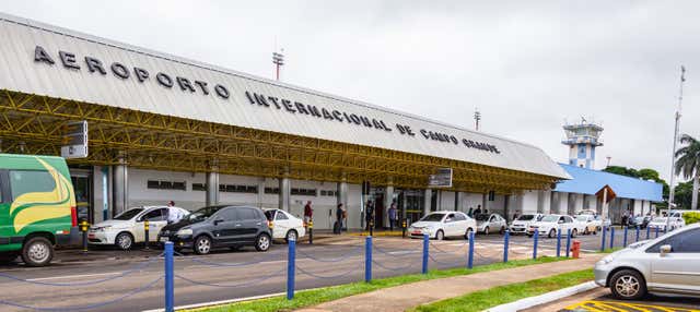
The airport most travelers use is Campo Grande International Airport (CGR), in Campo Grande, about 300 km from Bonito. Bonito has a regional airport, but with seasonal and limited flights.
The final stretch is by road: 300 km (about 4 h) on a paved route. You can rent a car at the airport, book a shared transfer, which is usually sold together with the tours, or take a bus. A car usually pays off because several attractions are dozens of kilometers from downtown.
Routes and airlines change often; the safest approach is to check them when planning your trip.
You can stay downtown in Bonito or in rural pousadas and farm hotels spread across the Serra da Bodoquena, some with trails and river swimming from the property itself. Since the attractions are on private property and sometimes dozens of kilometers from downtown, it is best to choose where to stay based on which tours you plan to do and how you will get around.
Rates change with the dates: confirm the price on Booking.com.
The dry winter, from May to September, usually brings more transparent water and less rain (July, the driest month, records about 36 mm). In summer, from December to March, it rains a lot and the rivers can stay cloudy for a few days after heavy storms.
No. On the float you wear a life jacket and let the current carry you, floating with mask and snorkel. It is an accessible activity even if you are not a strong swimmer.
It is not recommended. Most run by advance reservation, on private property, with a limited number of visitors per day and a voucher bought through an agency. The most sought-after sell out, so book earlier.
Yes. There are swimming spots, gentle floats such as the one on the Rio Sucuri and short trails. Each attraction has its own minimum age, so check the restrictions for each tour when building your itinerary.
Three to four days let you combine a cave, one or two floats, a swimming spot and, if you want adventure, the rappel into the Abismo Anhumas, without cramming everything into a single day.
It is 300 km, about 4 hours by car, on a paved route. You can rent a car at the Campo Grande airport, book a shared transfer, which is usually sold together with the tours, or take a bus, with a somewhat longer trip. A car usually pays off because several attractions are dozens of kilometers from downtown.
The weather and population data in this guide come from official agencies and open databases. Entry requirements and health recommendations change: always check the official source linked.